Cloud 9 – Day 7, Kata Tjuta and Uluru

Cloud 9 – Day 7, Kata Tjuta and Uluru

After a night at Haven backpackers, we continued on the third part of the Cloud 9: Uluru and Kings Canyon. I could finally see with my own eyes the legendary Ayers Rock or Uluru for Aborigines, and to some friends back in Brisbane “You – know – it’s – just – a – rock” when i asked them.
Uluru is located more than 400 kilometers from Alice Springs, so we were back in a bus for some long hours. First step of the day, a farm for tourists called Outback Camel Farm with local animals including several camels which you could possibly ride them.

A Camel

A Camel

An Emu

An Emu

After the farm, we drove a long distance through the desert. The guide stopped the bus in the middle of nowhere and asked us to gather as much wood as possible, it seemed that the nights are cold in winter. As we can see the vegetation is relatively scarce, not easy to find wood but lot of small dead things or active termite mounds. After a while we gathered enough wood to fill the bus roof, and hoped that the night would not be so cold.

A long Australian road

A long Australian road

After several hours of travel we were finally beginning to see one of the famous rock formations: Kata Tjuta, the brother (or sister) of Uluru. For the history part of the tour, our guide told us that there was a certain period where there are two kinds of holes at the distance of several kilometers and the wind pushed the pebbles and sand into these holes. The stones remained in the first and sand which is lighter was went into the second. After some time (decades i think), the holes were filled. Later, erosion lowered the ground level and ultimately the filled holes became Uluru and Kata Tjuta. Uluru is like an iceberg with a huge part still underground. As can be seen in the photos, Kata Tjuta consists mainly of rocks and Uluru is composed of sandstone. Wikipedia does not tell the same story but it’s still two remarkable formations.

Kata Tjuta

Kata Tjuta

Mother Nature

Mother Nature

After the tour of Kata Tjuta, we went to watch the sunset over Uluru with a glass of Champagne.
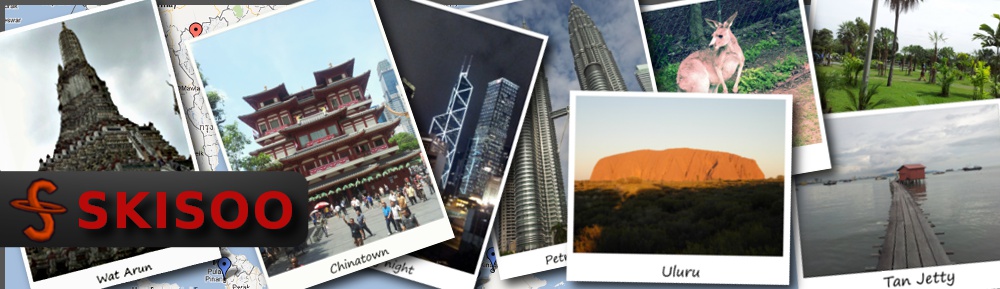
Uluru

Uluru

Once night fell, we went to camp. Although it was July, it was winter in Australia, and the guide told us that the temperature could drop to 5°C during the night but fortunately the roof of our bus was full of wood. We had the choice between small huts or under the stars in swags – they are kind of like sleeping bags but with built-in mattress. I chose the second option and the night was fine, neither too cold nor too hot.

Cloud 9 – Day 6, Devils Marbles and Alice Springs

Cloud 9 – Day 6, Devils Marbles and Alice Springs

By a crazy impulse of motivation, our guide made us get up an hour before sunrise (fortunately, it was winter) so that we could watch the sunrise from the famous granite blocks of the Devils Marbles. The Devils Marbles are a special granite rock formation that gives the impression of giant balls resting on other rocks. These are actually one rock (the boulders and the rock on which they seemed to lay on), after the effect of erosion. Their particular shape gave them the name “Devils Marbles”.

Some rocks

Some rocks

Rock cut in half

Rock cut in half

Karlu Karlu

Karlu Karlu

Just before lunch, we stopped at Barrow Creek, another pub following the tradition of leaving a little thing behind.

Our bus

Our bus

Barrow Creek Pub

Barrow Creek Pub

Several kilometers later we crossed the Tropic of Capricorn. We stopped there just to take the picture.

Tropic of Capricorn

Tropic of Capricorn

And finishing this 3 days tour, we finally arrived at Alice Springs – the city tucked in the middle of hills.

Entrance of Alice Springs

Entrance of Alice Springs

Alice Springs

Alice Springs

Cloud 9 – Day 5, Daily Waters Pub

Cloud 9 – Day 5, Daily Waters Pub

The night camp at Katherine (This is the name of the city) was cold, it might be the month of July, but it’s winter in Australia. When the guide told us that we would begin the day with a swim in a hot spring, everyone was immediately happy. So the first stop of the day was a hot spring in the middle of nowhere. The water was pleasantly warm, the source which is actually part of a river with some current, so that you would actually float quietly without really swimming surrounded by a few turtles. The little swim was very nice, but the exit is quite violent (as i would call it) with the dropping water temperature and your towel is not very helpful when it is far away at the beginning where you left for the swim (I tried to swim against the current but was too difficult).

The hot spring

The hot spring

A few kilometers further on the road is Larrimah with the Pink Panther to welcome us to the Larrimah Wayside Inn. There is also a small free zoo with local animals, mainly kangaroos, birds, crocodiles and snakes.

Larrimah Wayside Inn

Larrimah Wayside Inn

Little Joey

Little Joey

We continued on and ate at the Daily Waters Pub, the oldest pub in the Northern Territory. The tradition is that everyone who goes there leaves a little something. The pub is full of all kinds of tickets, notes and other more or less personal stuffs. Daily Waters is also the place where the famous “Stuart Tree” is located. The Legend says that John McDouall Stuart (the famous explorer who first joined Darwin from Adelaide) has engraved a “S” in it.

The shoe tree at Daily Waters Pub

The shoe tree at Daily Waters Pub

Outdoor decorations at the Daily Waters Pub

Outdoor decorations at the Daily Waters Pub

The interior of the Daily Waters Pub

The interior of the Daily Waters Pub

Shop in front of the Daily Waters Pub

Shop in front of the Daily Waters Pub

Just before reaching our campsite for the night – Banka Banka station, the guide continued to Attack Creek, the point which marks the furthest northerly point reached by Stuart during his fourth expedition.

Memorial at Attack Creek

Memorial at Attack Creek

Better to refuel before

Better to refuel before

Cloud 9 – Day 4, Katherine Gorge

Cloud 9 – Day 4, Katherine Gorge

On days 4, 5 and 6 of Cloud 9 is the descent from Darwin and Alice Springs. 1500 km distance to travel on the only road that separates the two cities.

The day starts early as all days during the tours. The special 4 × 4 bus driven by the New Zealand guide was replaced by a bus, driven by an Australian. I found several of my companions of the previous days will be going on this same tour as me for the next few days and also new companions on board – an American, a Dane, a local couple and an English couple. After getting everyone from all over the world, the bus takes on the long road that lies ahead which is full of history.

The first stop was at the Adelaide River Inn, a motel lot used during the discovery of gold at Pine Creek, a nearby hamlet and is now known for hosting the bull ( now stuffed) who participated in the filming of Crocodile Dundee. Before heading back, we went swimming in the natural pools of the Adelaide River.

The bull from Crocodile Dundee

The bull from Crocodile Dundee

The bush around Adelaide River

The bush around Adelaide River

Small waterfall in Adelaide River

Small waterfall in Adelaide River

By early afternoon, we arrived at Katherine Gorge. Katherine Gorge is the series of 13 gorges containing waterfalls and rapids of the Katherine River which originates from Kakadu National Park. From the parking lot, we took a trail that goes up steep before revealing an incredible view of the magnificent gorges. Then the road descends to reach a small platform from which we took a boat that goes up the first two gorges. The boat can not continue further because of the fierce flow of the river current. On arrival, a path through the gorge and the rapids for those who want a second boat is available to continue further. I chose to stay in the rapids with a few people instead of taking the second boat to come back.

Katherine Gorge

Katherine Gorge

Geometric rocks in one of the gorges

Geometric rocks in one of the gorges

Cloud 9 – Day 3, Twin falls and Jim Jim falls

Cloud 9 – Day 3, Twin falls and Jim Jim falls

Day three of the Cloud 9 tour, we headed south on asphalt road at the beginning and then changed to a dirt road. For those who are more adventurous, they can try to get there by car (I saw some in the parking lot), but most prefer having a 4 wheels drive as the dirt road is over 50 kilometers and a passage was under 50 cm of water.

Passage submerged

Passage submerged

The first stop was for Twin Falls. After a few hundred meters walk from the car park we took a small boat. On the way we saw crocodile traps (bait is usually a leg of pork), normally only fresh water crocodiles can be found in these waters and although they are harmless if left quiet, rangers prefer to remove them.

Crocodile trap

Crocodile trap

A little walk after getting off the boat and we are faced with a beautiful double waterfall with a lot of water ‘falling’ from a waterfall in the dry season.

Twin falls

Twin falls

Then we turned back and went to Jim Jim Falls. We followed a small trail from the parking lot to get there. Several hundred meters of the waterfall was already a wonderful overview. At the end of the trail, there was a pool which can be crossed by swimming to reach a second pool at the foot of the waterfall. The second pool is three quarter surrounded by cliffs, hundreds of meters high, giving it a special impression of a world apart with little sun. The water of this pool is relatively cool compared to other pools or lakes seen in previous days. To swim in the middle of this lake is really refreshing. Jim Jim Falls waterfall is 200 meters high on a cliff, and I can guarantee that the shower we had at the base of the waterfall was really strong, not to mention – very cold.

Jim Jim falls in the background

Jim Jim falls in the background

Jim Jim falls

Jim Jim falls

After these two waterfalls, we had several hours drive back to Darwin, at the Cavenagh, the Backpacker in partnership with Adventure tours Australia.

Our vehicle during the tour

Our vehicle during the tour

Cloud 9 – Day 2, Barramundi Gorge and Ubirr

Cloud 9 – Day 2, Barramundi Gorge and Ubirr

Like most days during my journey, we woke up early , then breakfast. Once breakfast was finished, the camp was quickly demolished then back to our large 4 × 4 for few hours of driving (one easily loses track of time as distances are so great in Australia that any journey takes at least few hours).

Clearing along the way

Clearing along the way

A wild dingo

A wild dingo

The first stop of the day was Barramundi Gorge. The road getting there can be used by a simple car during the dry season. After the carpark, the path to get there is 2 kilometers walking through the Australian bush.

Sign before accessing Barramundi Gorge

Sign before accessing Barramundi Gorge

The trail we took, lead us to the top of Barramundi Gorge. It began with wooden walkways through lush vegetation. After some minutes, the vegetation thinned to make room for the rocks and a few minutes after, we arrived at the summit. There are small interconnected pools among the rocks that flow into a small lake. After all tiresome bush walking, the water came in refreshing indeed. The guide is a regular here and showed us a little secret passage under water connecting two pools.

Stream giving birth to the waterfall

Stream giving birth to the waterfall

The lake seen from above

The lake seen from above

Once all photos were taken from the magnificent view, we took the path in reverse to go to the lake level. The road followed the river was formed by the lake. Gradually as we approached the lake, the vegetation became scarcer and the sun got really hot (wearing a hat or cap is more than recommended). After several minutes of effort, we were rewarded with the lake of Barramundi Gorge.

On the way to the lake

On the way to the lake

Barramundi Gorge

Barramundi Gorge

In the afternoon, we headed to Ubirr. Along the way we encountered some impressive termite nests (up to 4 meters high).

Termite mount

Termite mount

Ubirr is a rock formation overlooking a vast plain. The place was inhabited by Aborigines for many years as evidenced by many old paintings. The paintings visible today covered many layers of earlier paintings, the aborigines would just redraw on top to tell another story.  The marked path from the parking lot lead us to various ‘art galleries’ and we stopped in front of the last one where our guide told us the story represented and explained us that this was one of the means of transmitting knowledge to children.

A hunter

A hunter

A fish

A fish

The path ended by climbing over the rocks. Once on top we had a wonderful view over a vast floodplain.

Arnhem Land floodplain

Arnhem Land floodplain

In the evening we stopped at a camp in Jabiru, the only “town” of Kakadu National Park.